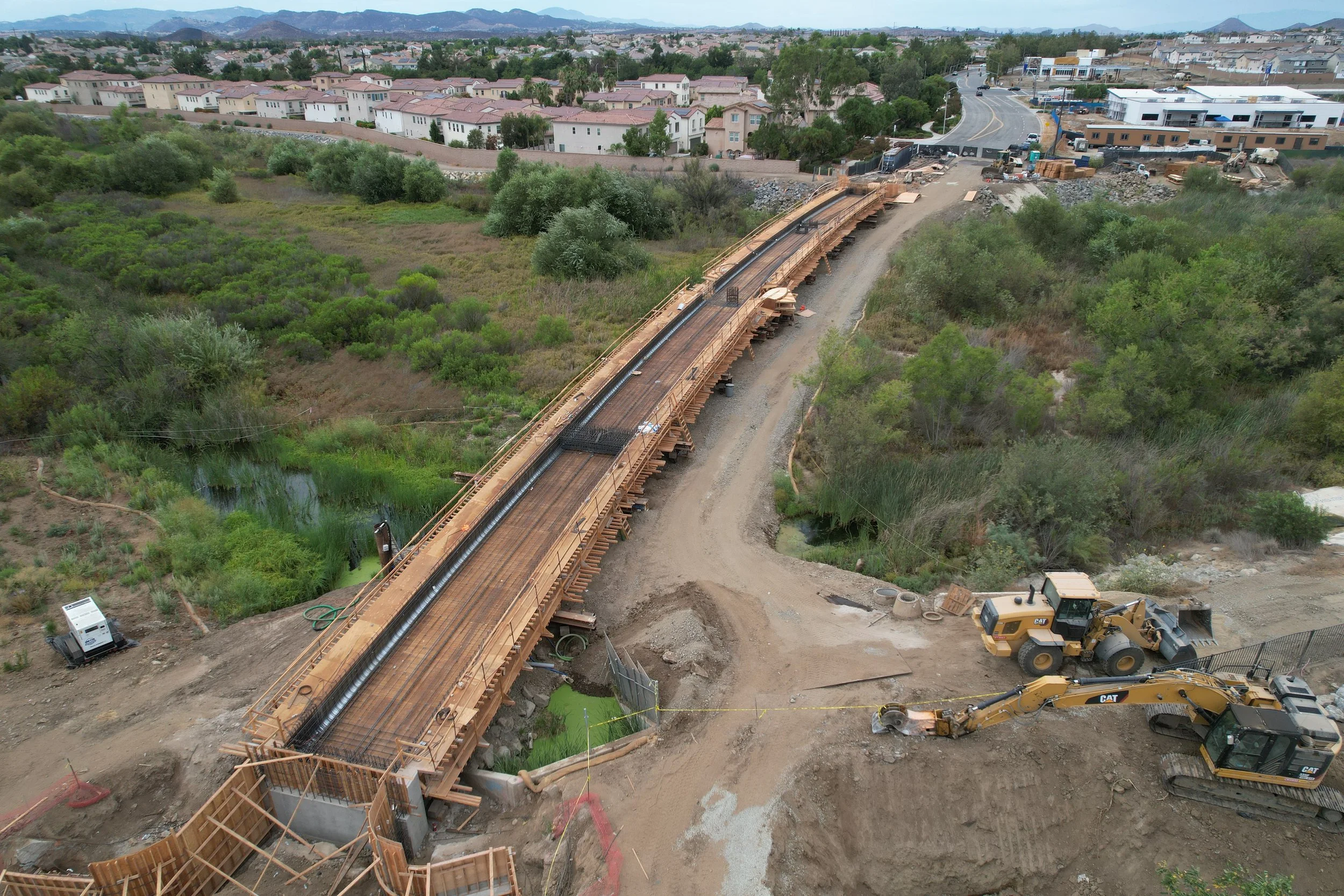
Orthomosaic Mapping and Site Progression
Welcome to Contreras Aerial Solutions, where technology meets Altitude. FAA Licensed and Insured. Specializing In orthomosaic mapping and site Progression saving you time, energy, and money.
Vetern Owned and Operated
Our Services
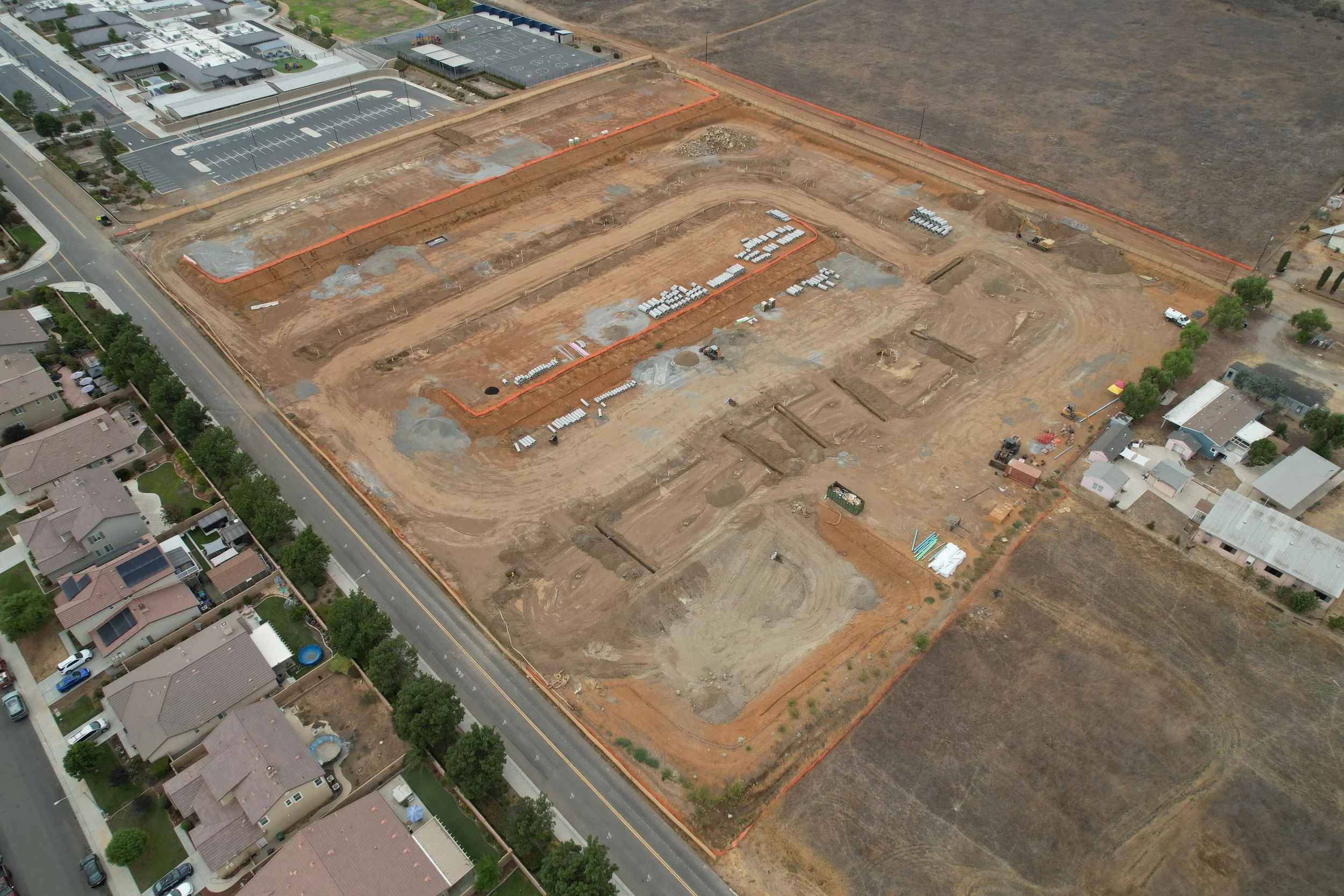
Track your project’s development using high-resolution aerial imaging, we document every phase of your construction or development site with precision, consistency, and clarity.
Whether it’s weekly, bi-weekly, or monthly updates, our drone service captures detailed overhead and angled views to provide a comprehensive visual timeline of your site’s progress. Ideal for project managers, stakeholders, investors, and marketing teams, these images enhance communication, improve documentation, and support compliance reporting.
Key Features:
High-resolution aerial photos from multiple elevations and angles
Consistent capture points for accurate progression comparison
Flexible scheduling (weekly, bi-weekly, monthly)
Safe and legal operations by certified drone pilots
Benefits:
Keep stakeholders informed with visual updates
Identify on-site issues early
Document construction milestones and timelines
Create compelling marketing and reporting visuals
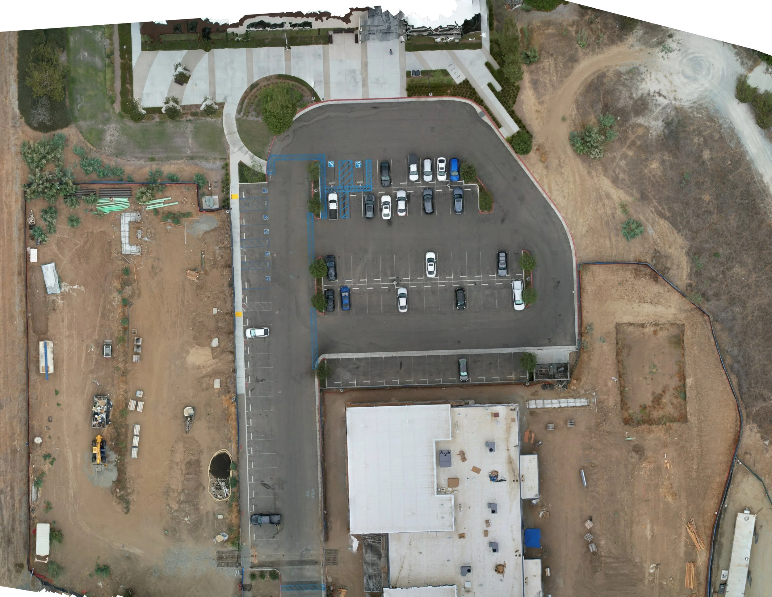
Orthomosaic Mapping with Drone Technology
Gain accurate, high-resolution maps of your site using advanced UAV technology and photogrammetry, we deliver detailed, georeferenced orthomosaic maps that are ideal for planning, and site management.
Each orthomosaic is stitched from hundreds (or thousands) of precisely captured aerial images, creating a true-to-scale, top-down map that reflects real-world dimensions and features with exceptional clarity and accuracy.
Key Features:
High-resolution, georeferenced orthomosaic maps
Compatible with GIS and CAD software
Fast data turnaround and secure digital delivery
Conducted by licensed and insured drone pilots
Applications:
Land surveying and site analysis
Construction planning and progress tracking
Environmental monitoring and inspection
Real estate and property development
Benefits:
Save time and costs vs. traditional surveying
Monitor large or hard-to-reach areas safely and efficiently
Improve project accuracy with detailed, up-to-date site data
Enhance collaboration with visual, data-rich maps

Measure stockpiles faster, safer, and more accurately using high-resolution aerial imagery and 3D photogrammetry, we calculate the volume, surface area, and contours of your stockpiles with precision, eliminating the need for manual, time-consuming, and potentially hazardous ground surveys.
Key Features:
Accurate volume and surface area calculations
High-resolution 3D models and orthomosaic imagery
Fast data turnaround and digital reporting
Safe, non-intrusive data collection—no need to climb piles
Applications:
Mining and quarry operations
Construction materials management
Aggregate and bulk material inventory
Environmental and waste site monitoring
Benefits:
Reduce measurement time and labor costs
Improve safety by minimizing on-site risk
Increase accuracy and consistency in volume tracking
Support audits, invoicing, and regulatory reporting with confidence